


Le Lachens-la Bastide-20-03-23

Christiancordin
Gebruiker


5h15
Moeilijkheid : Moeilijk

Gratisgps-wandelapplicatie
 SityTrail
IGN / Geografische instituten
SityTrail Plus
De wereld gaat voor u open
Over ons
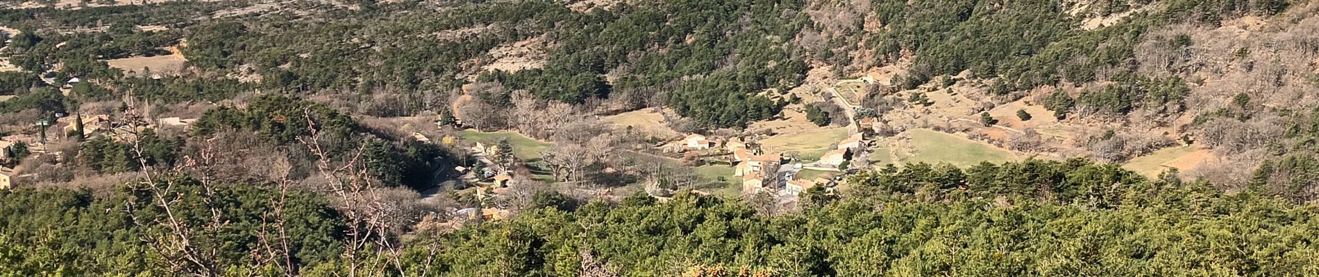
Tocht Stappen van 19 km beschikbaar op Provence-Alpes-Côte d'Azur, Var, La Bastide. Deze tocht wordt voorgesteld door Christiancordin.
Beschrijving
Départ pk hôtel du Lachens la Bastide où nous étions la veille en demi-pension je le conseille-GR 49-château ruiné-belvédère-montagne du Lachens-sommet 1712m- GR 49-Esclapon-entre le 12ème et 13ème Km difficile hors sentier-les hauts Varnins-le bas Varuins-clos Maroui-la Bastide.
Foto's


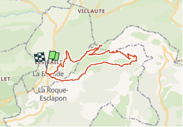
Plaatsbepaling
Opmerkingen